ALOBRAS
Distance from Albarracín: 41 km (55 minutos en coche) Altitude: 1.110 m. Population: 94
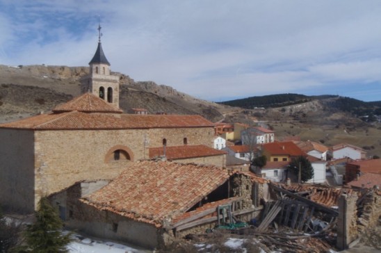
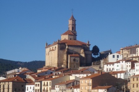
Alobras lies in the southern foothills of the Sierra de Albarracín. In its surroundings several springs can be found, most of which supply water for the watering place for the cattle. There is really only one building worth visiting, the renaissance-baroque church dating from the 17th century. This is compensated by the beautiful nature in the surroundings. De trip from Albarracín to Alobras leads through breath-taking landscapes.
Objects of interest: In and around Alobras some prominent trees grow (holm oak, Portuguese oak, Spanish juniper, black pine, elm tree). The latter two can easily be found:
Olmo de la Iglesia, the elm on the square in front of the church. In former times many villages had an elm on the village square. It formed the setting of many a ceremony (weddings, lawsuits, village feasts). As mycosis almost caused the distinction of the elms, this specimen is special.
Pino ramudo, a very old black pine tree, the branches of which almost reach down to the ground. The lower part of the tree is almost completely hollow, because the wood was used for the fabrication of torches. Fire further deteriorated the condition of the tree. You can find it after approximately 2 km on the right hand side of the road (camino forestal or pista Cañigral) leading westward from Alobras.
BEZAS
Distance from Albarracín: 15 km (15 – 20 minutes by car) Altitude: 1.165 m. Population: 70
Objects of interest: Three archaeological excavations sites near the Regachuelo river (Tajada Bajera, Tajada de Enmedio and la Tajada Somera or Peña del Hierro). The 16th-century church.
At short distance from Bezas lies an encampment of the so-called “maquis”. Maquis were Spaniards who fought the Franco regime, starting during the Civil war (1936 – 1936) well into the 60s.
Round the turn of the century it was opened to the public. Nature lovers will to come into one's own at the Bezas lagoon, a 4,5 ha pool with a rich fauna.
BRONCHALES
Distance from Albarracín: 28 km (30 minutos en coche) Altitude: 1.569 m. Population: 458
De Bronchales destaca su entorno natural. En los pinares del Puerto encontraremos el ecosistema del pino albar, con una gran variedad arbustiva y herbácea.
Most striking when visiting Bronchales are the extensive woodlands, “El Puerto”. The most common tree here is the Scots pine, next to a wide variety of bushes and herbs. The “merenderos” (el Canto, el Chorrillo, la Colmena or la Sima) offer perfect opportunities for a picnic. With numerous springs located throughout the area it is no wonder Bronchales has a mineral water bottling plant.
CALOMARDE
Distance from Albarracín: 17 km (15 – 20 minutes by car) Altitude: 1.312 m. Population: 78
There are various springs in the surroundings of Calomarde. The streams flowing through the plain form the perfect habitat of the trout.
Objects of interest:
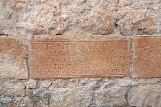
• The 17th century San Pedro Apóstol church with 2nd century Roman inscriptions.
• “El Rollo” a stone arch, some 10 m high, approximately 4 km before the village, coming from Albarracín.
• The Calomarde waterfalls (Cascadas del Molino Viejo), two km having passed El Rollo.
• The “cañon the los arcos”, a canyon with many caves and impressive rock formations.
CELLA
Distance from Albarracín: 23 km (25 minutes by car). Altitude: 1,023 m. Population: 3,030
Objects of interest
• The 16th century Iglesia de la Inmaculada. This church has a gothic frontage and, as a consequence of a restoration, a baroque interior.
• The town hall, 16th century, declared Cultural Heritage.
• The various chapels (Ermita de la Virgen del Loreto from the 16th/17th century, Ermita de San Antonio, Ermita de San Clemente, Ermita de San Sebastián from the 16th century and the Ermita de San Pedro Arbués from the 18th century)
• The “Fuente de Cella”, with 3,500 l/s the largest artesian spring in Europe (and second largest in the world).
In the vicinity of Cella:
• The Roman aqueduct dating from the 1st century AC, that acted as water supply system for a small Roman town that should be under the modern Cella. The intake took place at a point in the river Guadalaviar near Albarracín
• The Cañizar lagoon, the second largest freshwater wetland in Spain after the National Park “Las Tablas the Daimiel” (Ciudad Real). It is possible to make trips through these wetlands, under guidance of experienced guides.
• Various hiking tracks traverse Cella:
• El camino del Cid, a trail that meanders over 2,000 km from Burgos to Alicante.
• El camino del Santo Grail, a trail from San Juan the la Peña (Huesca) to Valencia, approximately 500 km, that follows the 15th century route of the Holy Grail. Nowadays, the grail can be visited at Valencia´s cathedral.
• Vía verde de Ojos Negros, a 148 km trail along the route that was used to transport iron from the mines at Ojos Verde to the Valencia harbour.
EL VALLECILLO
Distance from Albarracín: 35 km (40 – 45 minutes by car). Altitude: 1,421 m. Population: 51
El Vallecillo is built on a slope on the right bank of the Cabriel river, the main tributary of the Júcar. In the Middle Ages there were 14 farmsteads in the El Vallecillo territory. This changed when the inhabitants decided to settle in one residential area, Val Longuiello. Objects of interest:
• The 18th century Iglesia La Santísima Trinidad, made out of nature stone.
• In the Lóbrega (or Úbriga) cave remnants of Neolithic age have been found.
• The springs of the river Cabriel, near the springs of the Tagus (Fuente García). Near the so-called Ojos the Cabriel the flow increases considerably.
• The waterfall near El Molino de San Pedro, one of the most beautiful sites of the Sierra of Albarracín.
FRÍAS DE ALBARRACÍN
Distance from Albarracín: 23 km (20 -25 minutes by car). Altitude: 1,496 m. Population: 181
In the sierra, only the municipality of Albarracín has a bigger area of woods. The vegetation is mostly Scots pine and juniper.
Objects of interest:
•The archaeological excavations that indicate livestock about 1,400 BC.
•The source of the Tagus at 10 km from Frías
•The “sima”, or sink-hole, formed by water dissolving the local limestone (karst). You will find the sima indicated on the right side of the road when driving from Frías to the source of the Tagus.
• The 19th-century Iglesia de la Asunción
GEA DE ALBARRACÍN
Distance from Albarracín: 13 km (10 minutes by car). Altitude: 1,031 m. Population: 435
Sus edificios más destacados son el Ayuntamiento, la Casa grande de los Reyes de Aragón (con interesantes pinturas murales), la iglesia barroca de San Bernardo y los conventos del Carmen y las Capuchinas.
Objects of interest:
•The town hall
•La Casa Grande de los Reyes de Aragón
•The baroque Iglesias San Bernardo
•Two monasteries: Convento de los Carmelitas Descalzos and Convento de Monjas Capuchinas
•Very much worth a visit is the Roman aqueduct Albarracín – Gea – Cella. The information centre is in Gea.
GRIEGOS
Distance from Albarracín: 35 km (35 - 40 minutes by car). Altitude: 1,604 m. Population: 136
Griegos is the highest village in the Sierra de Albarracín. At an altitude of 1,604 meters Griegos is also one of the highest villages in Spain. At short distance from Griegos lies a restaurant (Alto de La Muela de San Juan,) that could well be the highest restaurant in Spain opened all year round. (> 1800 m).
It is not surprising that there are several cross-country skiing tracks that lead through beautiful landscapes. More information can be found on http://www.esquinordicolamuela.es/. Griegos was almost totally destroyed during the Spanish Civil War (1936 – 1939). Therefore it makes quite a modern appearance.
Objects of interest:
• The mountains of El Puerto and La Dehesa
• The viewpoint el Mirador Alto de la Muela
• In the meadows and pine tree forests and especially so on slopes southwest of Griegos bulls run loose. They are bred to star in “cultural and sportive events”.
GUADALAVIAR
Distance from Albarracín: 35 km (40 minutes by car). Altitude: 1,519 m. Population: 275
Here the river Guadalaviar (white river in Arabic) springs. After the junction with the Alfambra river it forms the Turia. The village has a long tradition in the field of livestock and the trashumancia, the seasonal north- south migration of livestock to suitable grazing grounds. Guadalaviar even has a museum dedicated to the trashumancia.
Objects of interest:
•The Iglesia Santiago from the 17th century.
•The nature: the pine tree forests of la Dehesa Boyal, the El Gavilán canyon, the melt water spring “La Vasequilla”, la Cañada the los Ojos, la Dehesa del Río, Mojón Blanco, el Bercolar, la Umbría and finally the Montes Universales and the bordering Sierras de Cuenca and Molina.
JABALOYAS
Distance from Albarracín: 32 km (40 - 45 minutes by car). Altitude:1,405 m. Population: 82
Jabaloyas lies in a plain at the foot of the mountain Jabalón. Via oral tradition of the history of this village witchcraft plays an important role. In 2010 the first “Witch days of Jabaloyas” were held, organized by Teruel´s UNED (a kind of Open University) and the municipality. Objects of interest:
•The Iglesia de la Asunción (15th century), the oldest of the sierra. The sacristy was plundered in 1936 during the Spanish Civil War (1936 – 1939). The woodcarvings on the doors are the only work of art that was spared.
•Some mansions with gothic aspects: la Casa de la Sirena and la Casa de los Diezmos.
•The top of the Jabalón offers a nice view over Jabaloyas.
MONTERDE
Distance from Albarracín: 17 km (20 minutes by car). Altitude: 1,280 m. Population: 54
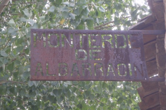
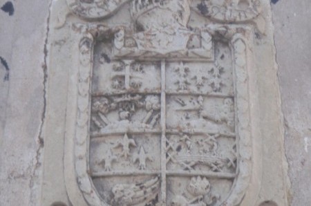
The name Monterde seems to stem from a farmstead that Don Pedro Ruiz de Azagra, lord van Albarracín, gave to one of his knights whose family name was Monterde. The house of Monterde plays an important role in the history of Albarracín, but also in that of la Casa Grande: above the main entrance hangs the coat of arms of the line of Monterde.
MOSCARDÓN
Distance from Albarracín: 20 km (20 minutes by car). Altitude: 1,415 m. Population: 61
Moscardón is superbly located, on top of a cliff and towers over the Barranco de El Castellar, an extremity of the valley of Masegar. Moscardón is built on a strategic location: from here, el Andador, the highest (and oldest) tower of the Albarracín wall is visible.
Objects of interest:
•The town hall.
•The Iglesia San Pedro Apóstol, 18th century, on top of a sheer cliff.
•The old water basin/mill in two enormous buildings.
•The nature: beautiful landscapes and geological phenomena like la Vega de la Hoya, los Pozuelos, the pine tree forest of la Cañada, la Muela, el Barranco del Recuenco and the stream Masegar.


